Remote Sensing and Data Integration with Advanced UAV and Geospatial Solutions
Our innovative UAV solutions, built on advanced geospatial intelligence, cutting-edge technology, and integrated with smart systems, offer comprehensive, high-precision mapping, remote sensing, and real-time data analysis. These solutions empower organizations across various sectors to achieve seamless automation, optimize resource allocation, and enhance operational efficiency while addressing critical challenges like surveillance blind spots, traffic management, environmental monitoring, and law enforcement.
Applications of Remote Sensing
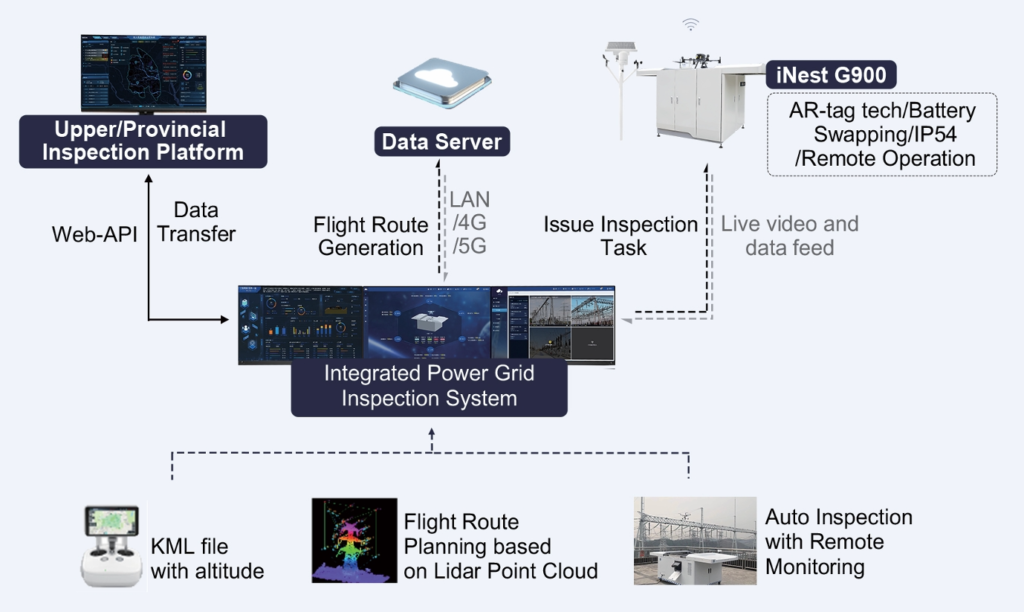
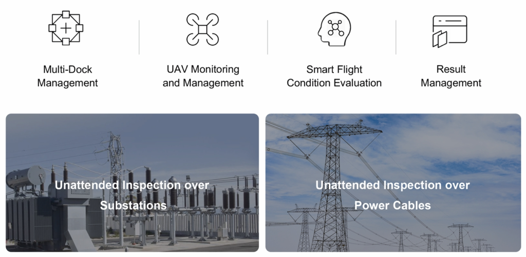
Power Grid
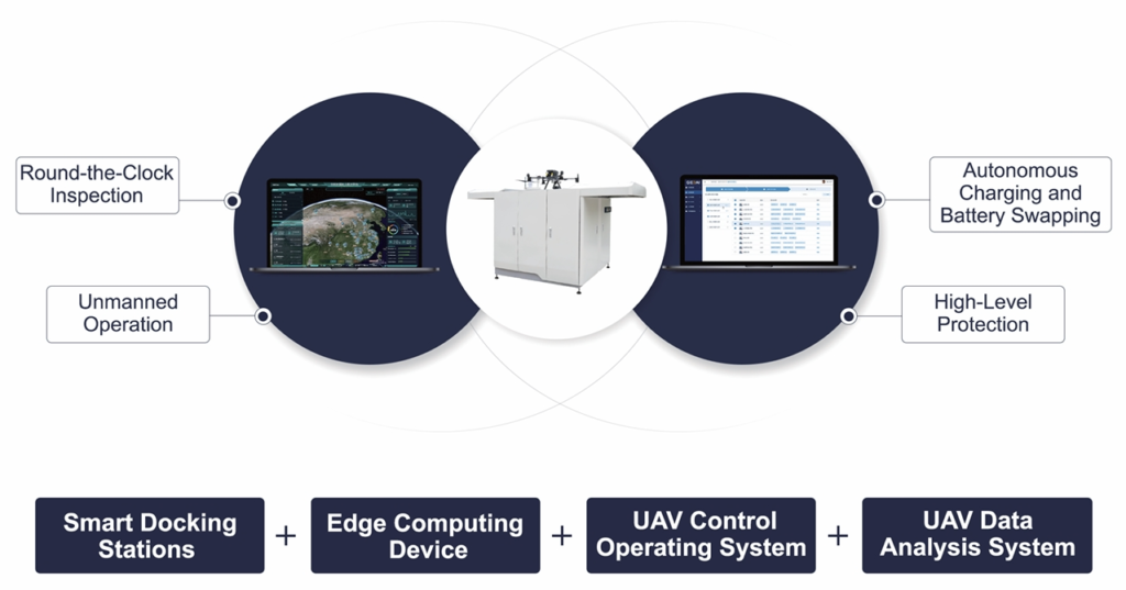
In various business scenarios such as power transmission, transformation, and distribution inspections, we leverage smart UAV docking stations as foundational infrastructure, powered by geographic spatial intelligence algorithms (GeoAI). By integrating multifunctional sensors and advanced technologies, we enable intelligent inspections of power grid systems.
Our comprehensive unmanned power inspection solutions encompass the entire process, from data acquisition and processing to data analysis and practical application. This streamlined approach enhances efficiency, accuracy, and safety across power grid inspections.
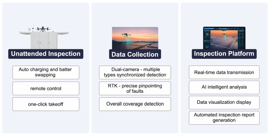
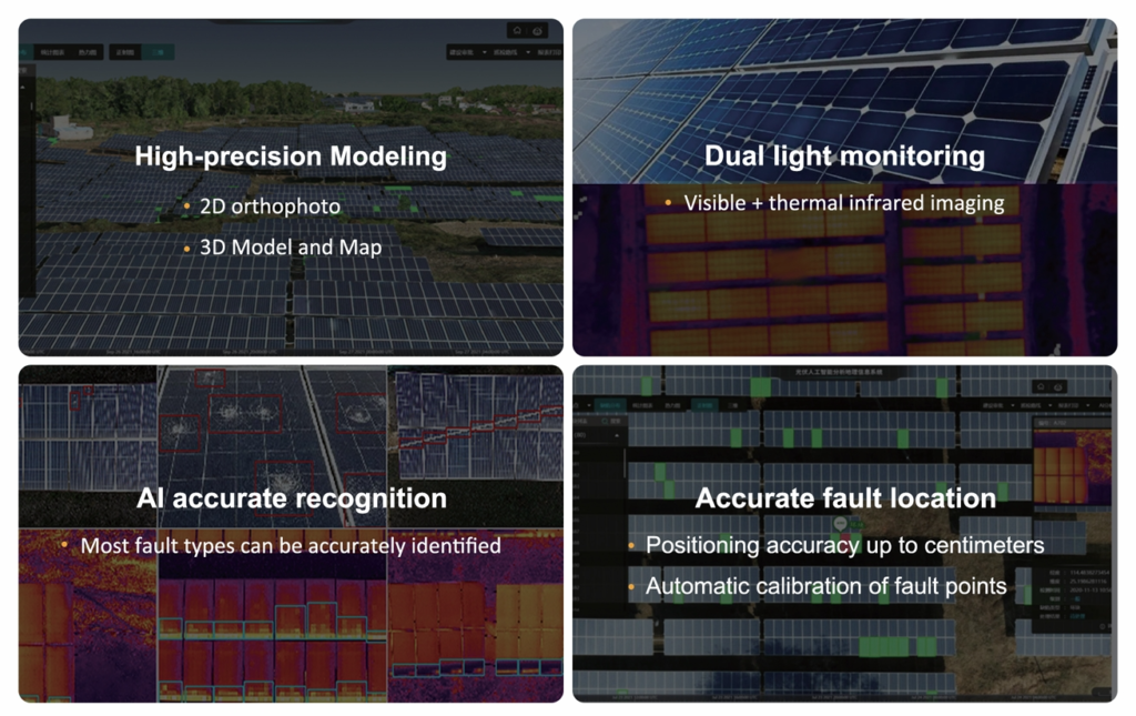
Solar Energy
Full-lifecycle UAV automated inspections address the challenges of traditional photovoltaic inspections, including transportation difficulties, low efficiency, and high costs. By automating the entire process, we provide a more efficient, cost-effective, and reliable solution for photovoltaic system management.
Oil and Gas Pipelines
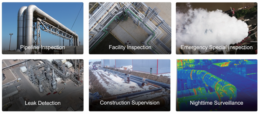
Full-lifecycle UAV automated inspections revolutionize oil and gas pipeline monitoring by overcoming traditional challenges such as accessibility issues, low operational efficiency, and high costs. Our advanced solutions ensure seamless, efficient, and cost-effective pipeline inspections, enhancing safety, reliability, and environmental compliance across the oil and gas industry.
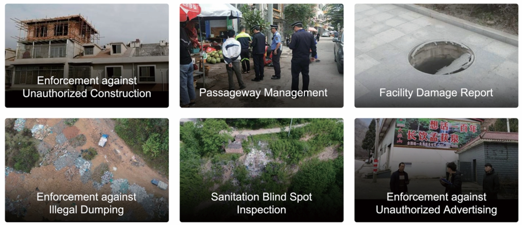
Urban Grid Management
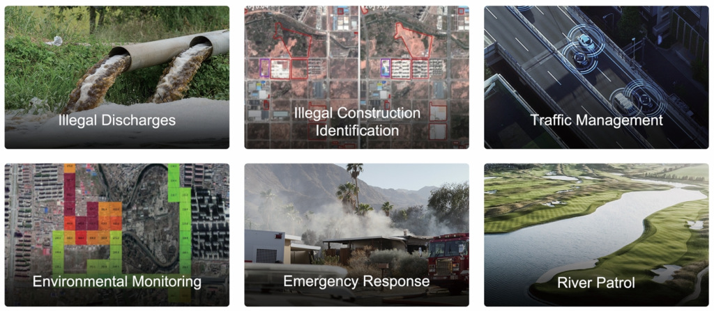
Grid management divides urban areas into unit grids based on unified urban governance principles and digital platforms. This approach establishes a management framework that separates supervision from operations, incorporating advanced inspection capabilities to monitor components and events within each grid.
The primary function of this system is to empower grid administrators with the tools to comprehensively collect and manage information on the five key elements within their responsibility areas: people, places, events, objects, and components. This ensures a more efficient, systematic, and intelligent approach to urban management.
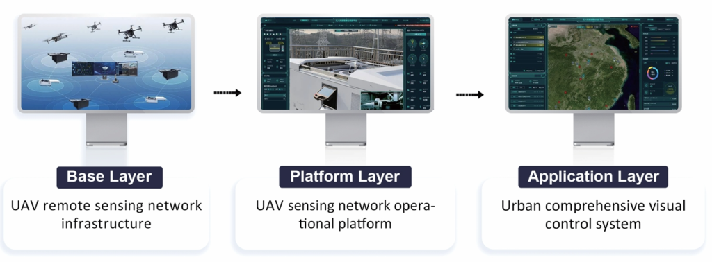
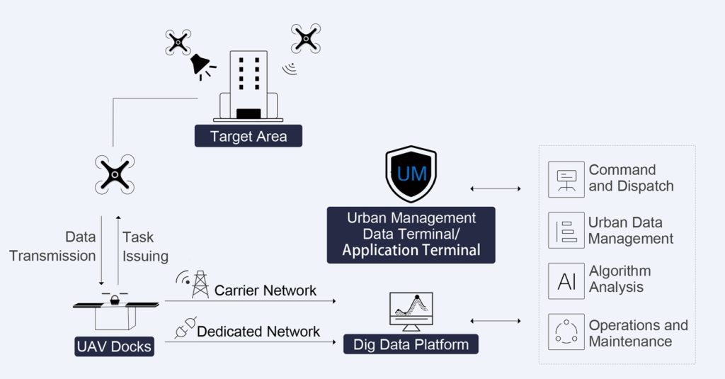
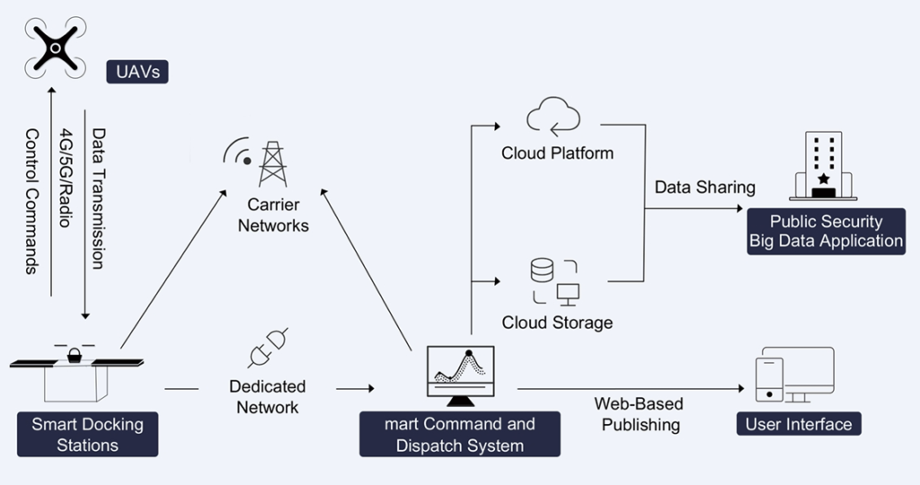
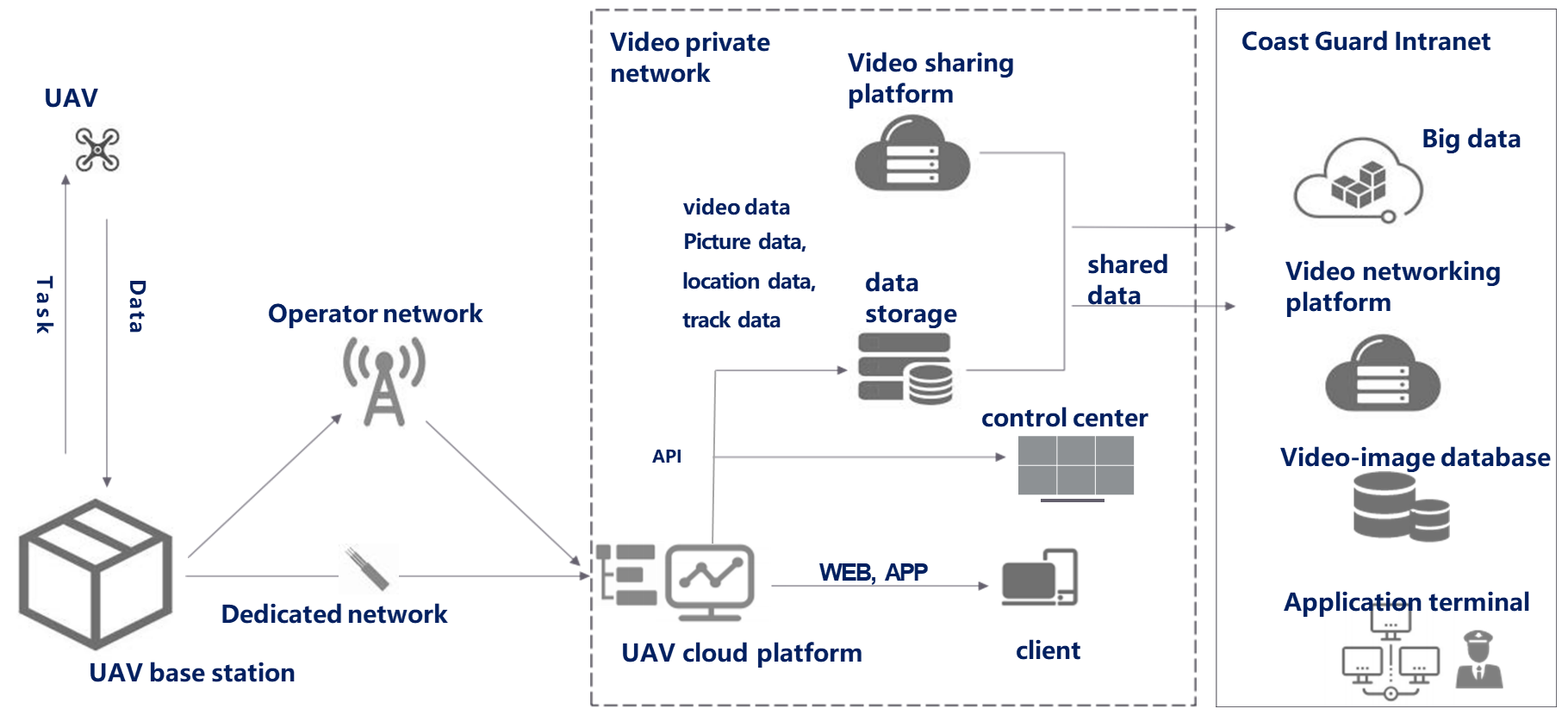
Leveraging 5G network connectivity and advanced drone networking technology, we offer high-frequency, round-the-clock, rapid-response drone intelligent inspection and recognition services. These services are tailored to meet the needs of government departments, including public security, emergency response, urban management, land management, water management, and environmental protection.
Our solution ensures seamless integration, real-time data transmission, and efficient decision-making to support critical operations and enhance overall management capabilities.
Urban Management
By utilizing a low-altitude UAV remote sensing network equipped with diverse payloads, we enable frequent patrols and designated spot monitoring. This approach facilitates the rapid identification of suspicious areas while ensuring seamless coverage of the entire inspection zone.
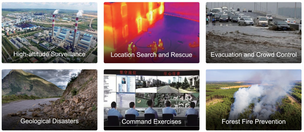
Emergency Response
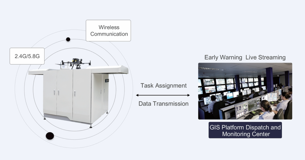
An unmanned drone emergency response system, operational 24/7, ensures rapid deployment to any scene. Equipped with high-definition video cameras and a multi-source perception setup, the system provides decision-makers with a comprehensive and diverse array of real-time information, empowering swift and informed responses to critical situations.
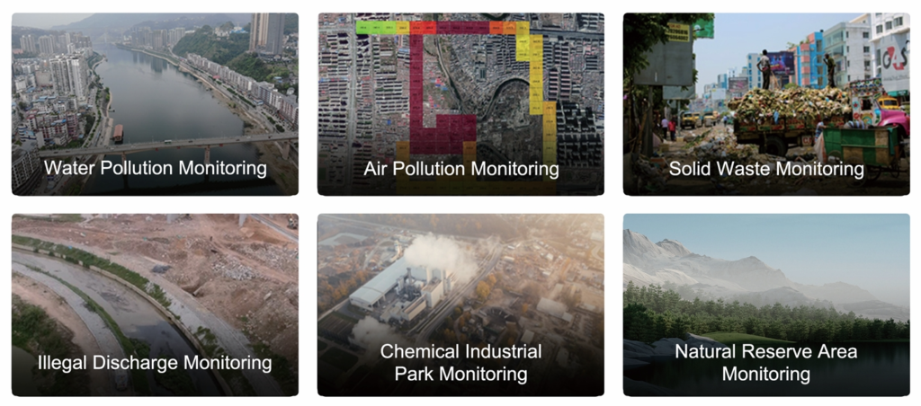
Environmental Protection
An integrated land-air environmental monitoring remote sensing network marks a new chapter in ecological civilization and environmental protection. This advanced system enables comprehensive, real-time monitoring and analysis, laying a strong foundation for sustainable environmental management and ecological preservation.
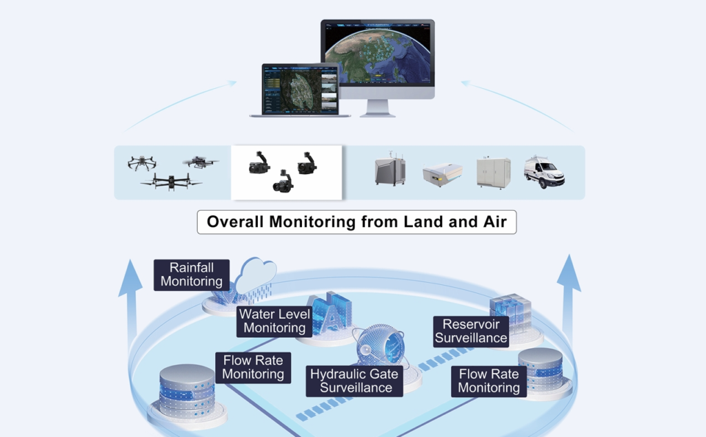
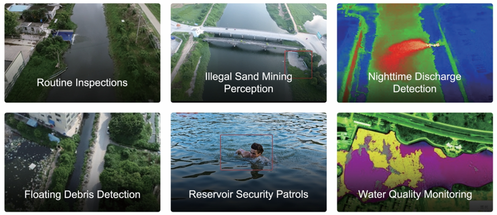
Water Management
By combining high-resolution satellite imagery with low-altitude UAV remote sensing networks, authorities can establish an all-weather remote sensing system for water environments. This application seamlessly integrates land and aerial devices, enabling intelligent water management through real-time monitoring, data-driven insights, and enhanced decision-making capabilities.
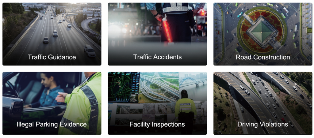
Traffic Control
Our system supports rapid evidence collection for urban road violations, facilitating swift enforcement actions. Additionally, it aids in high-speed patrols and emergency traffic congestion mitigation, ensuring efficient traffic flow and enhanced urban mobility management in real-time.
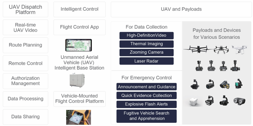
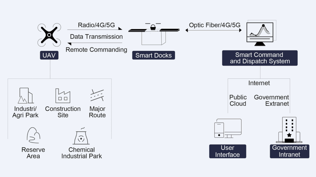
Public Security
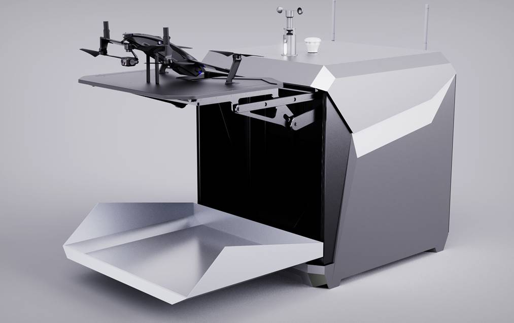
This innovative smart policing model leverages UAVs, smart docking stations, and an intelligent command and dispatch system to eliminate surveillance blind spots and enable comprehensive, automated patrolling across all scenarios. By streamlining operations, this system optimizes police resources, reduces the workload of law enforcement, and enhances overall public safety management.
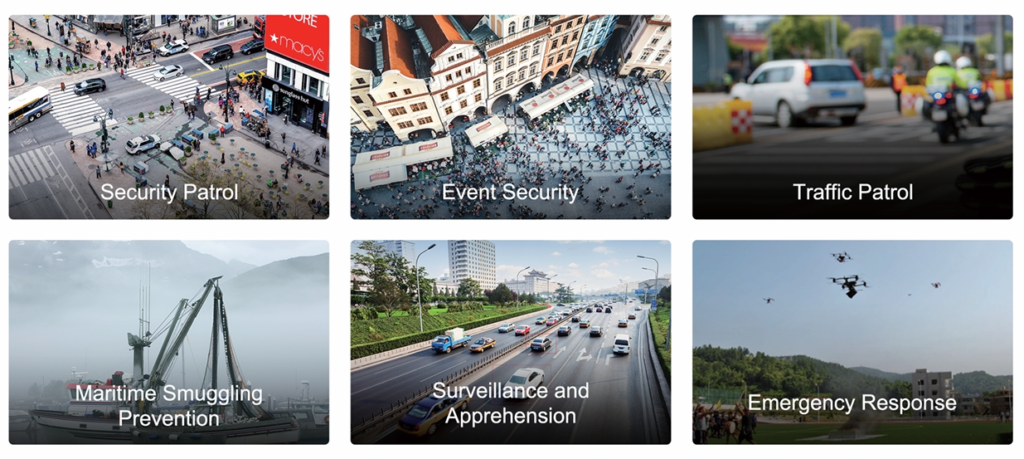
Coastal Patrol
Combines advanced UAV technology and AI recognition to deliver efficient, automated, and accurate coastal surveillance. UAVs autonomously patrol vast areas, rapidly respond to incidents, and provide real-time situational control. Equipped with high-definition cameras and AI capabilities, they can distinguish safe activities from illegal or hazardous behaviors, ensuring proactive management of coastal security.
This solution reduces operational costs, enhances safety, and provides actionable intelligence for monitoring maritime traffic, detecting illegal activities, and safeguarding coastal infrastructure. It is an ideal tool for law enforcement, environmental protection, and disaster response agencies.
Professional Services
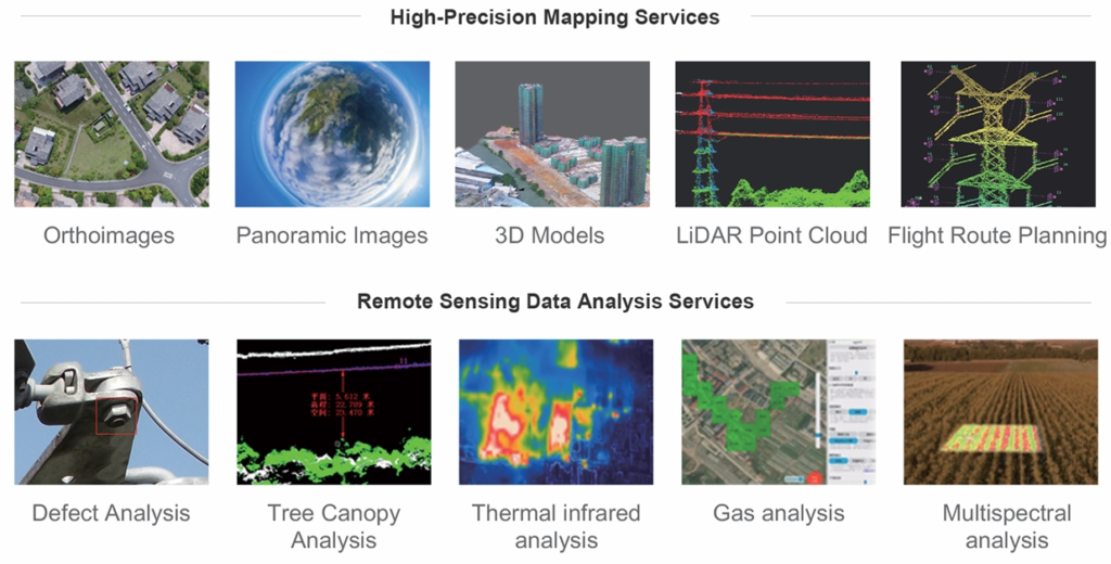
We offer professional services, including high-precision mapping and remote data analysis, designed to deliver accurate, actionable insights. Our advanced solutions ensure reliable data collection and in-depth analysis for a variety of industries, supporting informed decision-making and efficient operations.
Transform Your Insights
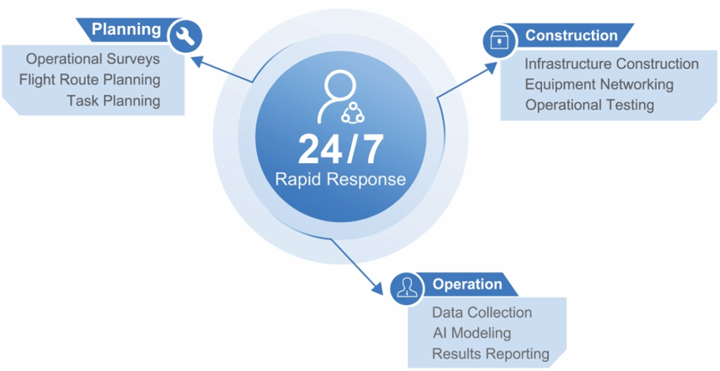
Leverage our advanced UAV solutions to unlock comprehensive geospatial intelligence and elevate your operations with state-of-the-art technology. Our innovative tools provide unparalleled accuracy, real-time data, and actionable insights, empowering your business to operate more efficiently and make informed decisions.